Personal Location Tracking

I’ve been pretty fascinated with the idea of recording my own location for a while now. I started using Foursquare at SXSW in 2009 and have mostly continued to do so since then (I have over 3,700 check-ins). You can see my check-ins being syndicated back to this website (using Keyring Social Importers), and if you scroll back through the history of the main page, you’ll get maps aggregating a few check-ins at a time.

TripIt helps me keep track of all (most) of my travels, and provides back some data (via API), which I also import into this site. Here are all of my trips since March, 2008.

In February last year, I started using Moves, and quickly came to love its simplicity. It’s a background app that runs on your phone and keeps track of your location. Using server-side data processing, they crunch the raw location information to figure out when you were walking, running, riding, or on some form of transit, then give you back a timeline and a map showing what you’ve been up to. It’s a really nice “set and forget” way of keeping up with how many steps (roughly) you’re doing each day, plus your other forms of exercise. The app has continued to make small improvements, and then on April 24, Facebook bought them. I can’t say I’m stoked about the acquisition, but regardless, it’s a cool app, and it collects some fantastic data.

Since it’s all data, and there’s a growing sphere of location/movement-related data services out there, shuffling your data around is just a matter of a little programming. As I mentioned, I’m importing my Foursquare data into my blog already. I also have a Moves importer that’s currently creating a text-only summary of my information. I’ll probably add simple maps to it at some point. Moves-Export is a pretty neat service that will automatically import your Moves data and can give you a better breakdown of things, plus auto-post to Runkeeper and Foursquare (if you like) when activities are over certain thresholds (e.g. riding for more than 15 minutes). Pretty awesome.

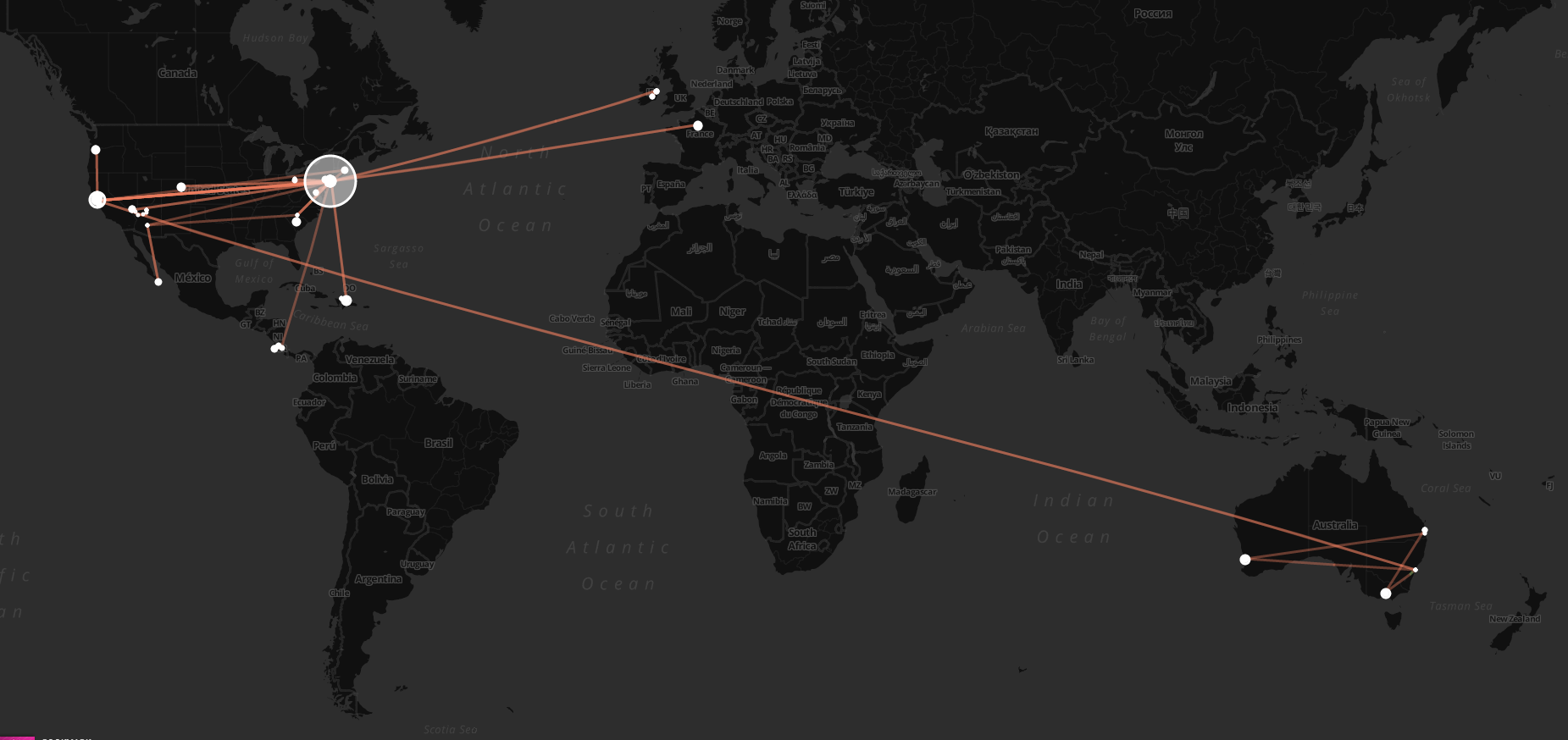
Today, Chris Messina tipped me off to Move-o-scope, an awesome web app that will slurp in your Moves data, and give you back a rich visualization of it all. It lets you toggle things on and off, pan around the globe and see what you’ve been up to. It’s fascinating. Here are some places I’ve been since last February!

It’s fun to turn on the “Transit” layer (orange/brown, seen in the last picture above and the first one in the post), and follow the lines around the globe to see where you’ve been, then turn it off and zoom in to get a feel for what ground you covered while you were there.

Exploring a Neighborhood Like an Engineer

When I moved to Brooklyn in June, I decided that I wanted to get to know my new neighborhood reasonably well, reasonably quickly. Being an engineer, I figured a methodical approach was the best solution, so I got a map and got to work.

Based on a rough understanding of what was where, and letting the nearby Prospect Park somewhat dictate the area I wanted to cover, I drew out a grid with my new home roughly at the center, covering the bulk of the surrounding area that was of interest. The grid looked like this: (more…)

Where is Your Digital Hub/Home?

I’ve been using WordPress to power my own website for a while now, and working with it in some way or another for even longer. Over the years, I’ve developed the belief that it’s a pretty perfect platform for people to build their own “digital home on the web”, considering the range of plugins and themes available, the flexibility of the publishing options it offers, and the fact that it’s completely open source, so you can do whatever you want with it.

That last bit is important in more ways than you might immediately think. Apart from just being able to write my own plugins or tweak my themes, this also means that I own my own data. I think in this MySpace/Facebook generation, people are all too loose with the data trails they create — giving up ownership of their digital self at the drop of a hat. In case you didn’t realize, when you use something like Facebook, it is not the product, you and your data are the product.

(more…)

Stroll in the Park

It is now 12:04am, and I just got back from a walk.

There are a few things about this walk to make it notable:

  1. I got up from my desk at 11:35pm and headed out for a brisk walk, mainly so that I could try to get over 6,000 steps today.
  2. I measured my steps using a Fitbit, and had the specific target because it’s part of an internal fitness challenge Automattic is hosting through Keas.
  3. I took the chance to compare Fitbit to RunKeeper for measuring walking (mainly looking at distance accuracy, but also at calorie burn).
  4. A guy (probably high) most definitely lined me up to attempt to mug me, he even tried to walk with me/talk/engage to distract me and get me to stop, but I out-walked him and he kind of gave up.

So; fun stuff all around. Here’s the data, from RunKeeper:

and for the same time period from Fitbit:

What’s interesting here?

  • FB reports that I burned 163 over RK’s 126; that’s a 23% difference.
  • FB reports that I covered 1.22 miles, while RK reports only 0.76 miles. Almost 40% difference.
  • Pace is barely even worth comparing when distance is so differently recorded. Time even shows as 40 seconds different, although I’ll give FB the benefit of the doubt and assume it’s rounding.
  • You can actually see the part where the guy approached me, because I sped up. If you look at the map from RK, it was on Larkin St, between Broadway and Pacific. He tried to “walk with me” so that he could get me to stop, but instead I just walked faster. I topped out right there at 14.4 minutes per mile according to RK (just over 4 miles per hour).
  • If I hadn’t been trying to meet a daily fitness goal, I wouldn’t have been walking around at midnight, making myself a target for getting mugged 🙂

Maybe I should run instead of walking, since high/homeless/whatever people are even less likely to give chase?