
I’ve been pretty fascinated with the idea of recording my own location for a while now. I started using Foursquare at SXSW in 2009 and have mostly continued to do so since then (I have over 3,700 check-ins). You can see my check-ins being syndicated back to this website (using Keyring Social Importers), and if you scroll back through the history of the main page, you’ll get maps aggregating a few check-ins at a time.
TripIt helps me keep track of all (most) of my travels, and provides back some data (via API), which I also import into this site. Here are all of my trips since March, 2008.
In February last year, I started using Moves, and quickly came to love its simplicity. It’s a background app that runs on your phone and keeps track of your location. Using server-side data processing, they crunch the raw location information to figure out when you were walking, running, riding, or on some form of transit, then give you back a timeline and a map showing what you’ve been up to. It’s a really nice “set and forget” way of keeping up with how many steps (roughly) you’re doing each day, plus your other forms of exercise. The app has continued to make small improvements, and then on April 24, Facebook bought them. I can’t say I’m stoked about the acquisition, but regardless, it’s a cool app, and it collects some fantastic data.
Since it’s all data, and there’s a growing sphere of location/movement-related data services out there, shuffling your data around is just a matter of a little programming. As I mentioned, I’m importing my Foursquare data into my blog already. I also have a Moves importer that’s currently creating a text-only summary of my information. I’ll probably add simple maps to it at some point. Moves-Export is a pretty neat service that will automatically import your Moves data and can give you a better breakdown of things, plus auto-post to Runkeeper and Foursquare (if you like) when activities are over certain thresholds (e.g. riding for more than 15 minutes). Pretty awesome.
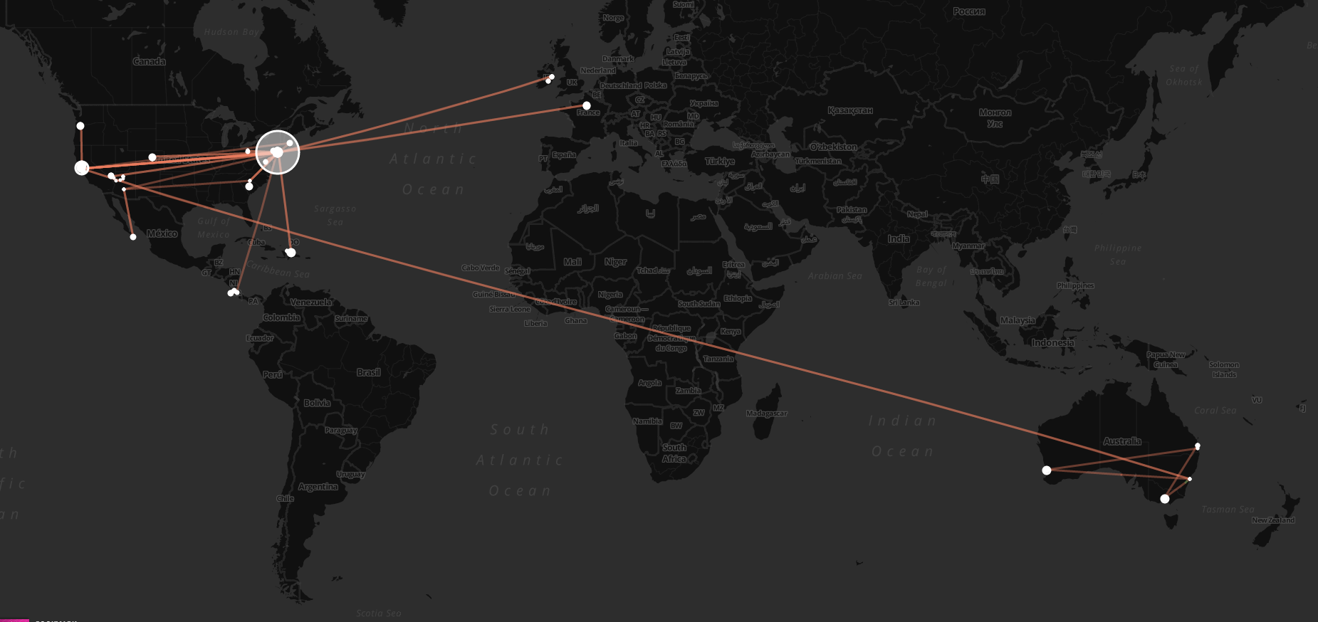
Today, Chris Messina tipped me off to Move-o-scope, an awesome web app that will slurp in your Moves data, and give you back a rich visualization of it all. It lets you toggle things on and off, pan around the globe and see what you’ve been up to. It’s fascinating. Here are some places I’ve been since last February!


It’s fun to turn on the “Transit” layer (orange/brown, seen in the last picture above and the first one in the post), and follow the lines around the globe to see where you’ve been, then turn it off and zoom in to get a feel for what ground you covered while you were there.


