

Pretty epic (and exhausting) ride of Travois trail today that ended in hail and a downpour. Worth it. #sentinel #mtb #mountainbike #colorado

Pretty epic (and exhausting) ride of Travois trail today that ended in hail and a downpour. Worth it. #sentinel #mtb #mountainbike #colorado
https://scontent.cdninstagram.com/v/t50.2886-16/70062041_376896642956518_8456465293877072941_n.mp4?_nc_ht=scontent.cdninstagram.com&oe=5D70483E&oh=852797f0f0db0e97f60dd36215dc4ce4
I tried videoing from my bike’s phone mount on the downhill. Pretty bumpy, but — wheeeeee! #mtb #colorado #enduro #downhill #video #singletrack


This year, for the third year in a row, I participated in the Fjällräven Classic USA here in Colorado. Read about the 2016 USA Fjällräven Classic and the 2017 USA Fjällräven Classic.
As with previous years, this was a 3 day, 2 night backpacking trip in the Colorado backcountry, hosted by Fjällräven and their sister brands. This year felt like they are really hitting their groove with organization, distance, and difficulty, and I think it was overall the “best” one yet.
Erika came along this year as well, and we did a lot fewer training hikes because we knew the course was significantly shorter, had both been really active all year, and were generally just pretty confident. We were also busy getting organized to get married (which happened the week after the Classic!), and I was breaking in a new mountain bike, so we had some other things on our schedules 🙂 Nonetheless, we got in a few training hikes (or rides) at Table Mountain and Aldefer/Three Sisters.
This year’s course was significantly shorter than last year’s (thank god). I think the first day was probably too short to be honest, and it left a lot of time at the end of the day to just sit around and… drink too much. That’s partially because we had to start earlier than last year (apparently a requirement of the Forest Service), so the day was just over really early. Day 2 was pretty long, and pretty hard, but there was a lot of variability (compared to last year’s long, hot, exposed slog), so I quite enjoyed it by comparison. I was definitely tired by the end of it though. Day 3 was “all downhill” and quite easy, although it went on a lot longer than expected based on looking at the map quickly.
Here’s the entire course, again created on the wonderful Caltopo. Note that these paths are based on trail information stored in their database, so it’s not necessarily exactly where we hiked. One of my friends on the trail said Day 2 in particular was quite different, and actually came out at more like 14 miles. I’m looking forward to tracking this myself using my Garmin watch next year.

We were heading up from Denver with my friend Michael, so we had to get a really early start. We arrived at Copper Mountain Resort by about 7am, so that we could get the last bus to the trailhead at 7:30. Once at Tennessee Pass, we got prepped, hit the trail, and made good time for the first day. From memory we got to Camp 1 by about 2pm. The last section (through Camp Hale) was pretty flat, dry, and exposed, plus we were just trudging along gravel roads, so not that great. The rest of the day was nice single-trail through forest though, which was beautiful. Camp was on the grounds of Nova Guides, a snowmobile/ATV rental company based out of Camp Hale. They had a nice (fishing) pond, green grass, and plenty of space for us to all set up camp (either together on the grass, or a bit more dispersed up the hillside, which is what we chose). Our friends Rene and Michelle even had an amazing surprise for us, having lugged in a small bottle of champagne to pre-celebrate our wedding!


This was the long one, with all the elevation gain. Out of Camp Hale (early – we left at about 6:30am from memory), we wanted to try to clear the exposed valley floor before the sun got too high and hot. From there it was up, up, up, over Kokomo and Searle Passes, past Janet’s Cabin, and to Camp 2. We stopped for multiple lunches, had a photo shoot with one of the official photographers (it’s very awkward getting close-up video of each cheese and elk sausage), stopped to use the Grayl to get clean water, snapped a bunch of pictures from the amazing views, and trudged into Camp 2 pretty weary, but pretty happy.


The last day was a bit of a sleep in, break camp, then head mostly-downhill to the Trekker’s Inn, finish line, and closing party. We managed to intercept an ATV taking some supplies up the trail and snag a beer on the way down, and there were even llamas at the closing party!


We carried a small “passport” with us throughout the hike, which was used to keep track of us (stamped at each checkpoint/campsite), and also included a map. It had some details from Leave No Trace and info about sponsors as well.


As I mentioned earlier, I think this was the best organized/executed iteration of the USA Classic yet. Before going, I had sort of decided that it’d probably be my last for now, and that I’d go on my own backpacking adventures rather than do this again next year. After going again though, I’m reminded of the fun I have, the great people, and the sense of accomplishment that I think is different in a group setting than it would be on my own (or even with just a few close friends). If the timing works out again, I think you’ll probably see another of these posts from me again next year :).
Note on numbers: distances and elevation are from Caltopo, so they’re based on the trail data they have available, for the specific trail that I’ve marked out (which is I think pretty accurate). Steps, calories, and “total distance” per day are from Fitbit, using a Fitbit Blaze throughout the hike.
Other people’s experiences:


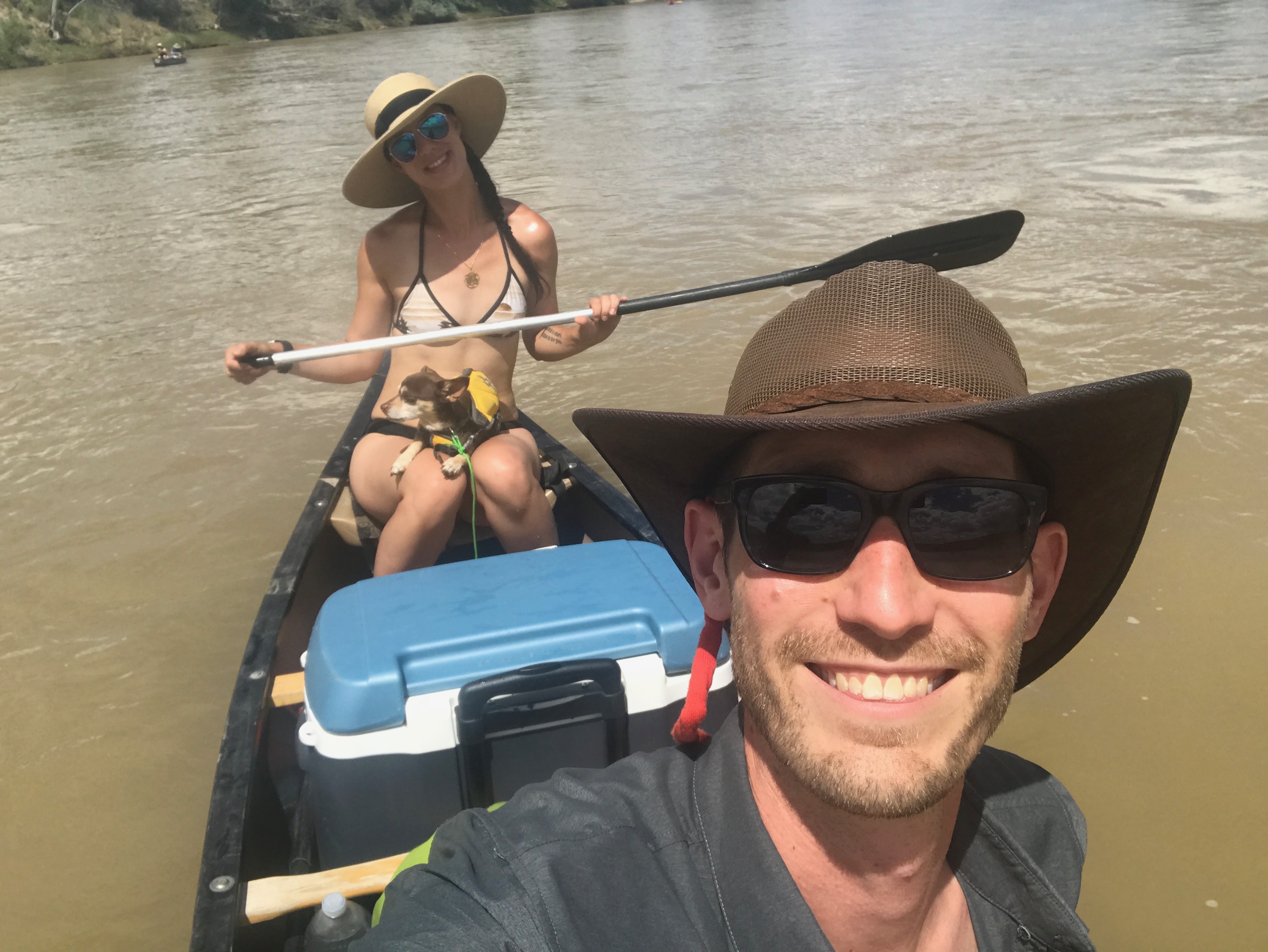
A few weeks ago, Erika and I joined some friends on the Colorado River for a repeat of a trip we took last year.
I got all my gear sorted out on Thursday afternoon/evening, then drove out to Fruita (our put-in point) on Friday morning. By noon we were all loaded up in our canoes and ready to hit the water.
This year’s highlight was probably the felon we ran into who claimed to be on the run. Seriously. Right when we started, we saw someone putting in on the other side of the river in a yellow kayak. Not too long later he caught up with us, and asked to borrow a phone. His story was confusing and rambling, but he claimed to be on the run from Federal Marshals, and was taking one last river trip before he was put away for 20+ years on a felony “paleolithic” offense, which apparently involved finding and trying to sell a dinosaur bone on federal property. The guy was wearing jeans and runners, and had nothing with him. Our guess is that he stole the kayak and was just making a run for it.
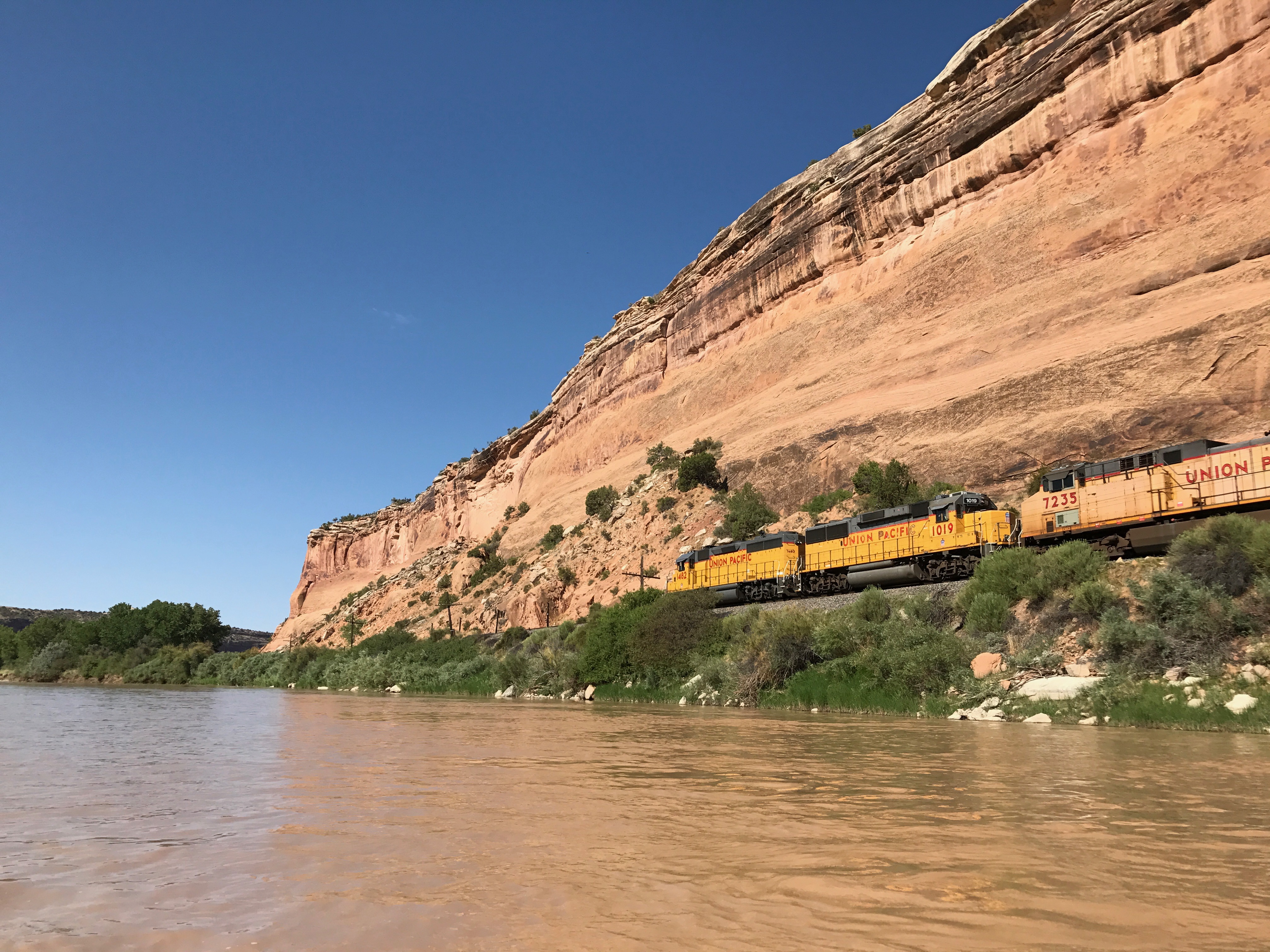
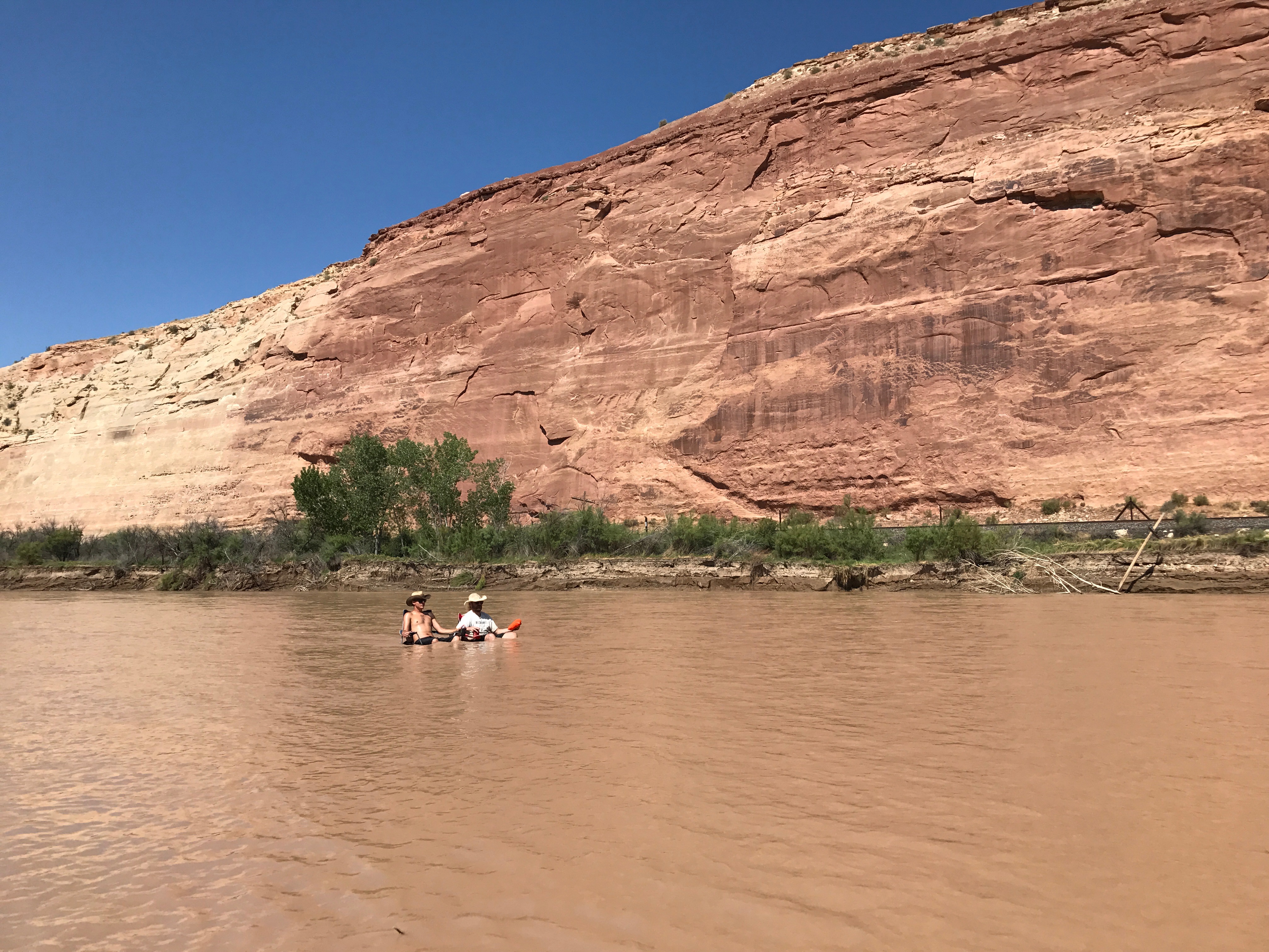
Other than our kayaking-felon, we were treated to the same beautiful cliffs and landscapes as we were last year. Some fun mini-rapids and lots of hanging out in chairs in the river, drinking beers. We also briefly saw some river otters on the last day which was a fun treat.


The first night’s campsite again turned out to be a rough one, even though we tried a very different one this time. It was super muddy to get in there, and then was again a total mosquito party. We found a spot inland a bit where we could set up a kitchen and hang out to avoid the mosquitos, but then it rained all evening, which made for a pretty muddy and dreary time. The next morning we went on a bit of a hike up into the valley/hills, checked out the scenery, then headed off for the day.

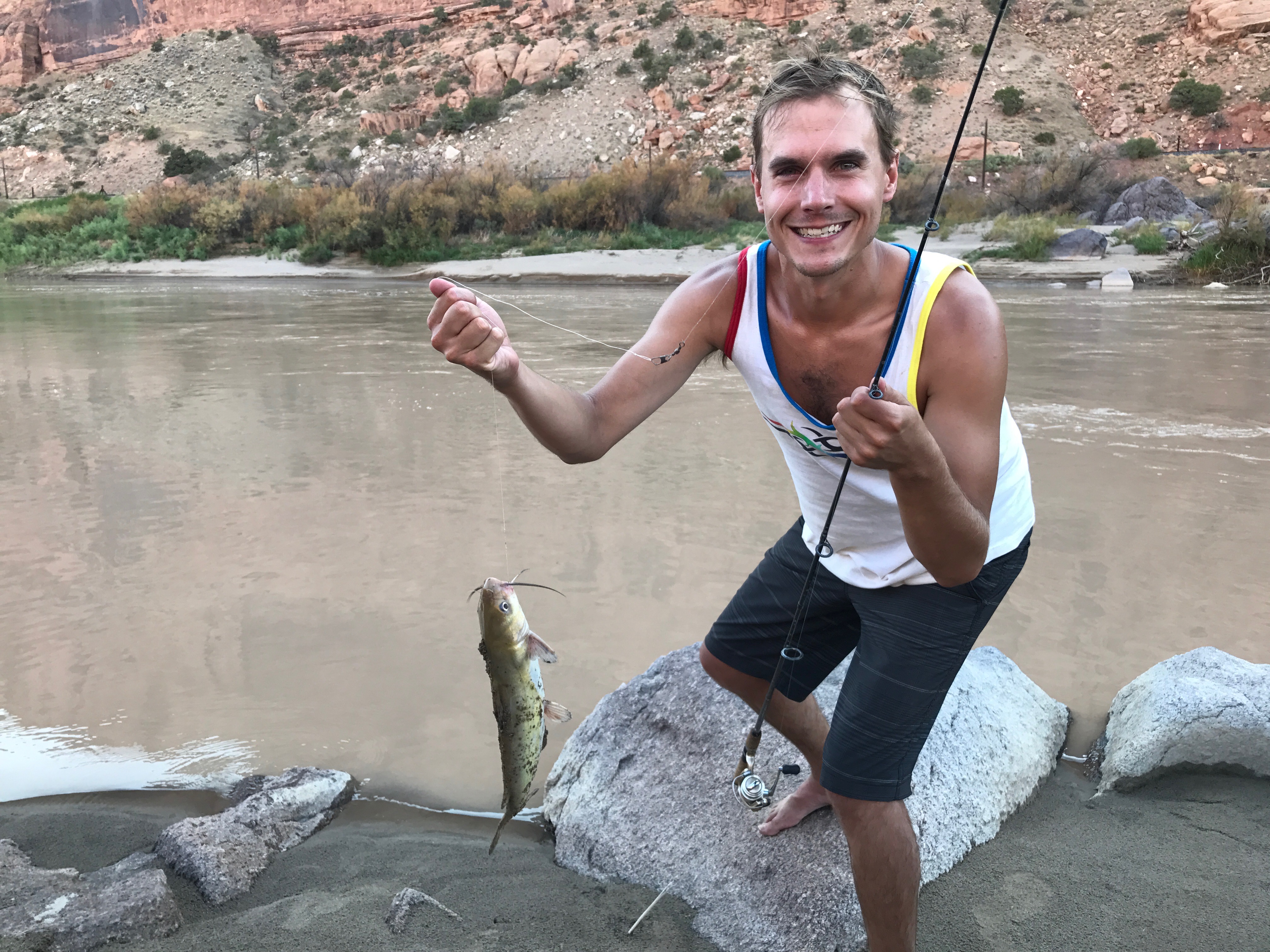


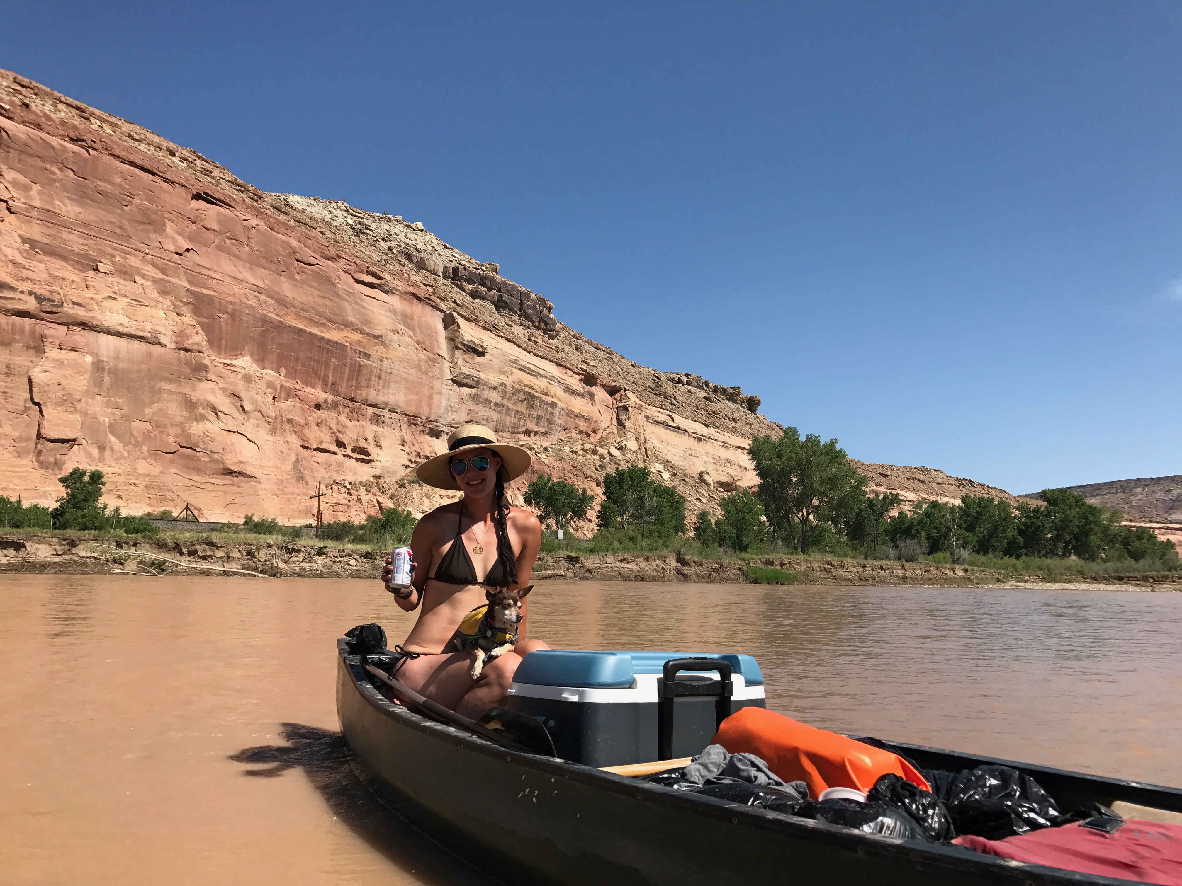
Day 2 (the only full day on the river) was a really lazy one, because we didn’t have that much distance to cover. We had a few nice long breaks, including a shot at some fishing and running some rapids in life vests (just laying back and floating them directly in the river). That night we stopped at Black Rocks 3 campsite, which was glorious. We had a beach to ourselves with soft sand, no mosquitos, and ended up with a beautiful clear sky. We lay around and watched the stars, admired the Milky Way, and generally just enjoyed the evening.


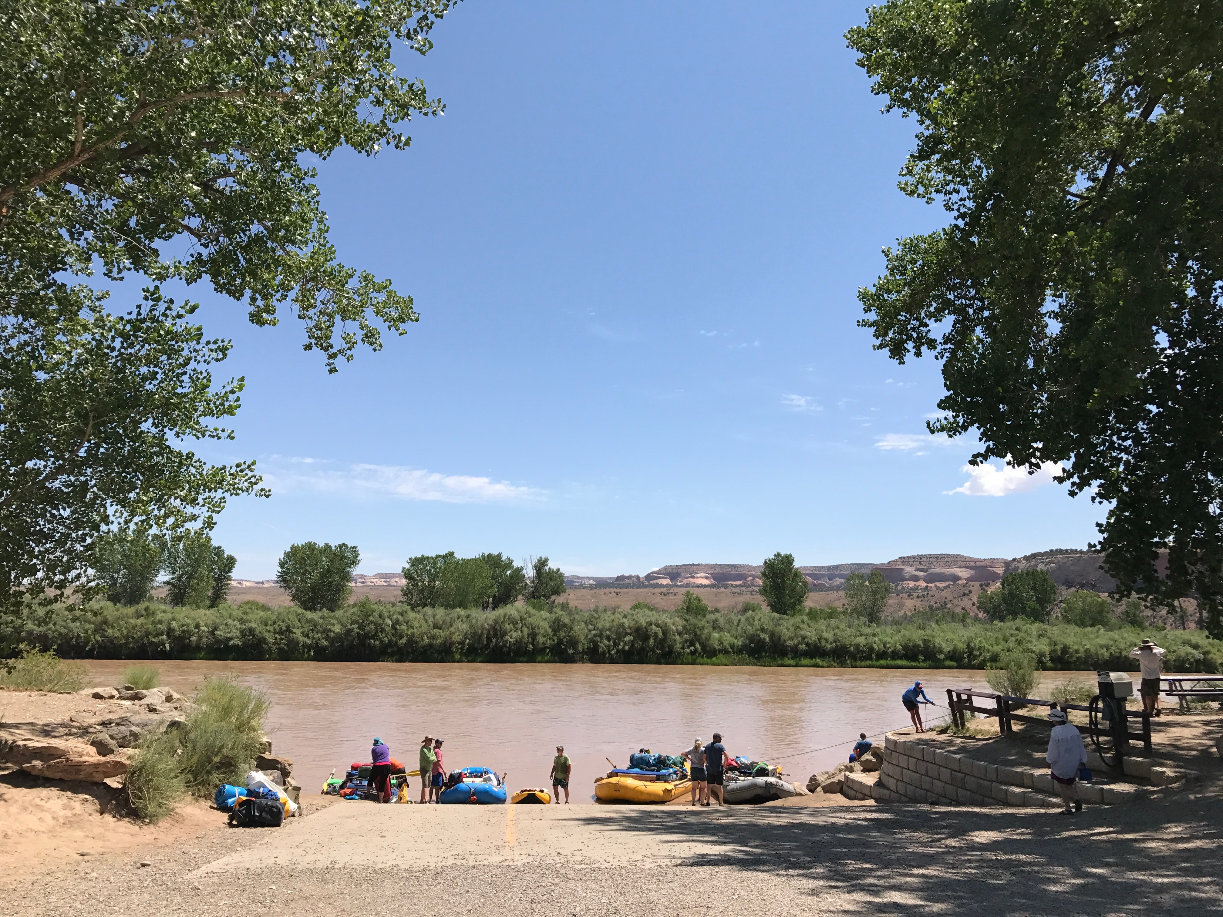
Since we had a schedule to keep on Day 3, we were up and at it in the morning, and got moving. We got buzzed by a plane while we were packing up (figure-8s in the sky!), then hit the river. When we got to the boat ramp, our ride was already there so we took out, packed up, and rolled back to Fruita. From there it was a matter of loading everything up, then making the 4 hour drive back to Denver so that we could unpack and clean, organize etc. Another great trip.
